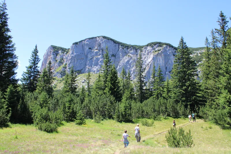
The best hikes around Žabljak are not always the longest or most technical. Some begin beside a famous lake, others climb to a canyon viewpoint or link several quiet lakes in one day. What matters is choosing a route that matches your experience, the weather and the time available.
This guide covers five verified Žabljak hiking trails. Every distance, elevation gain and difficulty rating below comes from the official Žabljak tourism route pages. The measurements below are retained from the original guide. Tourism pages may move or change; confirm the current route description, GPX data and conditions with the tourist organisation before setting out.
Important: an official difficulty rating is not a guarantee of safe conditions. Check the forecast, trail status, park information and daylight shortly before departure. Snow, fog, rain or mud can make even an easy route unsuitable.
1. Black Lake loop: the easy first walk
- Distance: about 3.5 km
- Best for: a relaxed first walk, families and photography
- Starting point: Black Lake, around 3 km southwest of Žabljak
The maintained path around Black Lake is the simplest introduction to Durmitor National Park. Forest, water and mountain views are packed into a short circuit, so it works well on an arrival day or when you have only a small weather window. The official Black Lake page lists the loop at 3.5 km and the lake at 1,418 metres above sea level.
Allow extra time for photographs and short stops. Park admission rules and prices can change, so confirm the current information rather than relying on an old blog or screenshot. See the official Black Lake information.
2. Ćurevac viewpoint: short route, enormous view
- Short approach: approximately 1.1 km from the parking area
- Time: plan about one hour for the short visit
- Viewpoint elevation: 1,625 m
- Full alternative from Žabljak: 17.74 km circular route, +340 m, medium difficulty
Ćurevac is one of the most dramatic viewpoints near Žabljak. The short version starts after a roughly 7 km drive from town and follows a rocky path from the parking area. Although the official description calls it easy, the path is narrow in places and can become slippery in rain.
Do not confuse this short viewpoint walk with the much longer circular route from Žabljak. Strong walkers can review the official 17.74 km Ćurevac route; visitors wanting the short approach should use the official viewpoint description.

3. Three Lakes: an easy Durmitor circuit
- Distance: 8.93 km
- Elevation gain: +172 m
- Difficulty: easy
- Route: Black Lake – Bosača – Jablan Lake – Barno Lake – Black Lake
This circular route is a useful step up from the Black Lake loop without committing to a steep summit day. It connects three very different lake settings and passes through Bosača, one of the high settlements above Žabljak. The official route ranges from 1,426 to 1,588 metres in elevation.
The modest elevation gain makes the walk approachable, but almost nine kilometres still require suitable shoes, water and enough daylight. Open the official Three Lakes route for the current route description and map resources.
4. Crvena Greda: a medium hike above the lakes
- Distance: 7.56 km
- Elevation gain: +389 m
- Difficulty: medium
- Highest point: 2,117 m
Crvena Greda offers a bigger mountain experience in a relatively compact route. The climb opens views towards Jablan Lake, northern Durmitor, Black Lake and Žabljak. Because the route reaches above 2,100 metres, conditions can be very different from those in town.
Choose this hike only when visibility, trail conditions and your group’s experience are suitable. Review the official Crvena Greda route before departure.

5. Žabljak Lakes: a longer circuit from town
- Distance: 11.33 km
- Elevation gain: +492 m
- Difficulty: medium
- Highlights: Žabljak, Black Lake, Barno Lake and Jablan Lake
This circular walking route connects Žabljak with several of Durmitor’s best-known lakes and alpine meadows. It is 11.33 kilometres long, with a total ascent of 492 metres. Its highest point is 1,843 metres above sea level. It is the longest route in this guide and has the greatest total ascent of the five routes listed. It suits visitors who want a substantial day walk without climbing a high summit.
Start early enough to keep daylight in reserve, especially outside midsummer. Download or save the route information before leaving town, because mobile coverage should never be your only navigation plan. See the official Žabljak Lakes route.
How to choose the right hike
- Limited time or uncertain weather: choose the Black Lake loop.
- Maximum scenery for a short walk: choose the short Ćurevac approach.
- An easy half-day circuit: choose Three Lakes.
- A steeper mountain day: choose Crvena Greda in stable conditions.
- A longer route from Žabljak: choose Žabljak Lakes.
Practical hiking checklist for Durmitor
- Check the official route page, weather, trail status and park notices shortly before departure.
- Carry water, food, sun protection and warm or waterproof layers.
- Use proper footwear; wet roots, rock and mud can change an easy path quickly.
- Save an offline map or GPX file and keep your phone charged.
- Turn back if visibility, weather, terrain or daylight becomes uncomfortable.
- Leave no litter and remain on marked routes.
For more ideas beyond hiking, see our guide to things to do in Žabljak. If you are planning a longer stay, the three-day Žabljak itinerary combines Black Lake, Durmitor scenery and the Tara Canyon at a realistic pace.
Stay near the trails at Villa Eagle
Villa Eagle gives families and small groups a comfortable base near Žabljak, with space to prepare for the day and relax after a walk. Explore the villa and plan your Durmitor stay on the Villa Eagle website.